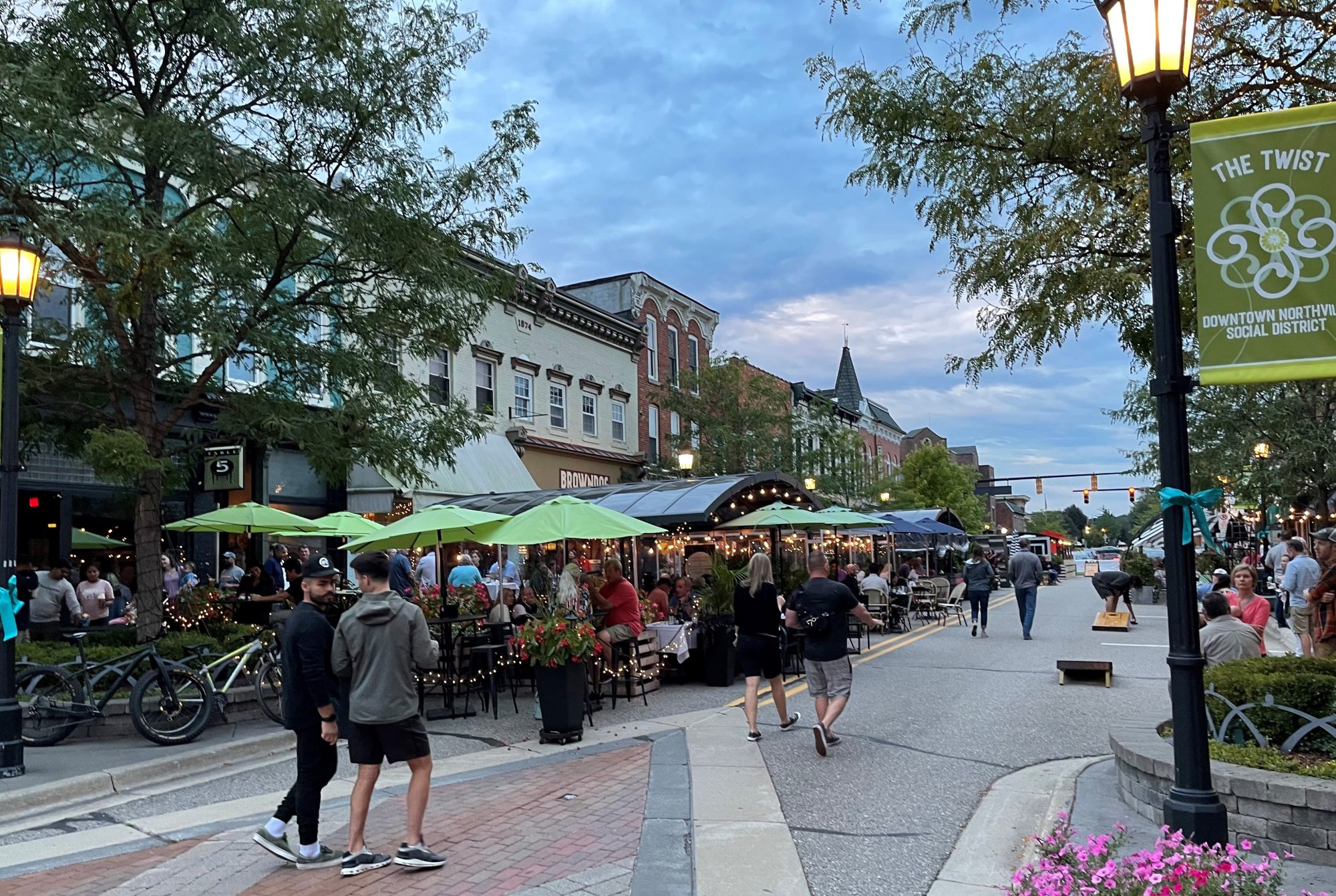
Downtown Street Closures
To help businesses and restaurants in Downtown Northville operate safely during the pandemic, the City of Northville and the Northville DDA closed portions of East Main Street and North Center Street to allow outdoor seating and retail merchandising and sales with a special event permit. Northville City Council voted at the August 1, 2022 meeting to continue the street closures indefinitely.
The Downtown Development Authority, after issuing an RFP and soliciting proposals from five firms, hired Grissim Metz Andriese Associates to implement a design plan for a pedestrian friendly downtown. Their analysis can be found by clicking here. The DDA Board of Directors has appointed a special Advisory Committee to work with GMA on next steps and the meeting dates and times can be found by visiting the Downtown Northville Calendar. The meetings are open to the public and are held in person, unless otherwise noted, at City Hall, 215 W. Main St.
- Kick-off Meeting: Thursday, October 27, 2022, 8:00 am
- Advisory Committee Meeting with GMA: Wednesday, November 2, 2022, 8:00 am
- Advisory Committee Meeting with GMA: Tuesday, November 29, 2022, 8:00 am
- Walking Workshop Meeting: Wednesday, December 7, 2022, 4:00 - 6:00 pm @ Marquis Theatre
- Traffic Planning Community Meeting, hosted by Fleis & Vandenbrink: Thursday, December 15, 7:00 - 8:30pm @ City Hall
- Advisory Committee Meeting with GMA: Wednesday, January 4, 2023, 8:00 am
- City Council/DDA Meeting, Thursday, January 19, 2023, 7:00 pm
Preliminary site analysis can be found here: Site Plan Analysis
Conceptual Design can be found here: Conceptual Design
Gateway Design can be found here: Gateway Design
Walking Workshop Presentation can be found here: Workshop
Pedestrian Plan Questionnaire: Survey
City Council/DDA Meeting Presentation: GMA Presentation

The most recent street closure survey was conducted from April 11, 2022 - May 2, 2022. Survey results can be found by visiting the following links:
- Street Closure Survey Final Report: Click Here
- Street Closure Survey Verbatim: Click Here
- Street Closure Survey Comments: Click Here
- Compiled Feedback on Street Closures: Click Here
Fleis & Vandenbrink has created an interactive web page to aid in gathering input for the traffic study. This map presents a map of the area being reviewed. This application gives people the ability to mark areas of concern and leave comments (view it here). All data received will help provide a better understanding of public concerns. DPW and F&V are collaborating with the Mobility Network, which is a sub team of the Sustainability Team and River Restoration Task Force.

